

2500 appx E Trout Creek Road -Wikieup, AZ 85360
Due to the health concerns created by Coronavirus we are offering personal 1-1 online video walkthough tours where possible.
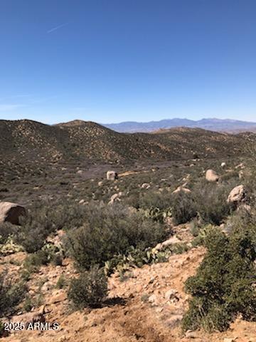
631 Acres of beautiful mountains, valleys, flat land....everything you would ever want in a secluded ranch away from it all but only minutes from the town of Wikieup and about one hour from Kingman! Plenty of State and Federal Trust land all around so bring your toys! Seller says depth for drilling a well is only about 250 feet! Trout Creek Road runs through all three parcels. See map pictures in the photos. Map starts at Lower Trout Creek Road entrance north of Wikieup, that is between Mile Marker 110 and 111. GPS Coordinates: 252-01-019: Latitude 34.8971242038619 Longitude -113.485372525131........252-01-020: Latitude 34.8934551623909 Longitude -113.485327012347........252-01-018: Latitude 34.9025463222907 Longitude -113.485282666322
| 4 months ago | Listing updated with changes from the MLS® | |
| a year ago | Listing first seen on site |
All information should be verified by the recipient and none is guaranteed as accurate by ARMLS. Copyright 2026 Arizona Regional Multiple Listing Service, Inc. All rights reserved.
Last checked: 2026-07-18 01:40 AM UTC